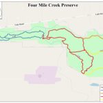
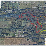
Consisting of 72 acres purchased in 2004 by the Town of Webster under the open space referendum, the preserve features sections of Four Mile Creek and its major tributary Salt Creek, as well as 2.15 miles of packed-dirt trails with three bridges and multiple boardwalks. There are a variety of ecosystems such as old growth forest, succession forest, and wetlands. There are multi-use trails for low-impact activities such as walking, biking, snowshoeing, and cross-country skiing. Dogs are permitted on leash.
The Cars! A highlight of the preserve is the presence of old cars along the Red and Yellow trails.
Fishing is permitted (license required) in Shipbuilders Creek. Special Great Lakes Tributary regulations apply. To report violations or concerns, please call 1-800-TIPP DEC (1-800-847-7332).
Motorized vehicles, fires, camping, firearms and trapping are prohibited.
Archery hunting is permitted seasonally for those enrolled in the town program. The season starts October 1 and ends in December, with hunting permitted from 30 minutes before sunrise until 10am, and from 3pm until 30 minutes after sunset. Other park users should wear blaze orange when using the preserve during those times.
Resources
A remembrance of early mills along Four Mile Creek.
Tales from the area that became Four Mile Creek Preserve.
eBird observations of bird species in Four Mile Creek Preserve.


