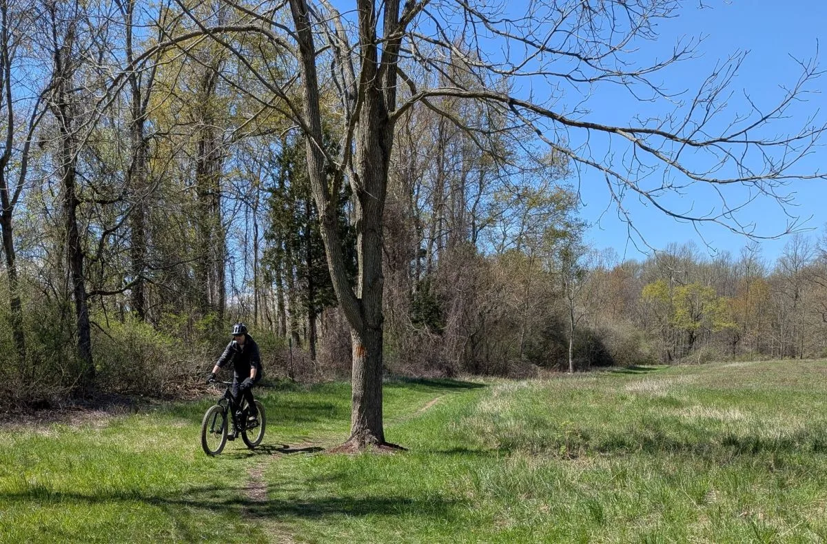
The Whiting Road Nature Preserve consists of approximately 240 acres with a variety of ecosystems which make it a beautiful area to enjoy nature.
The trails are restricted to non-motorized, designated multi-use trails for bird watching, snowshoeing, cross-country skiing, dog walking on leash, trail walking/running, horse riding and biking. The following activities are prohibited: fires, motorized vehicles, camping and athletic fields.
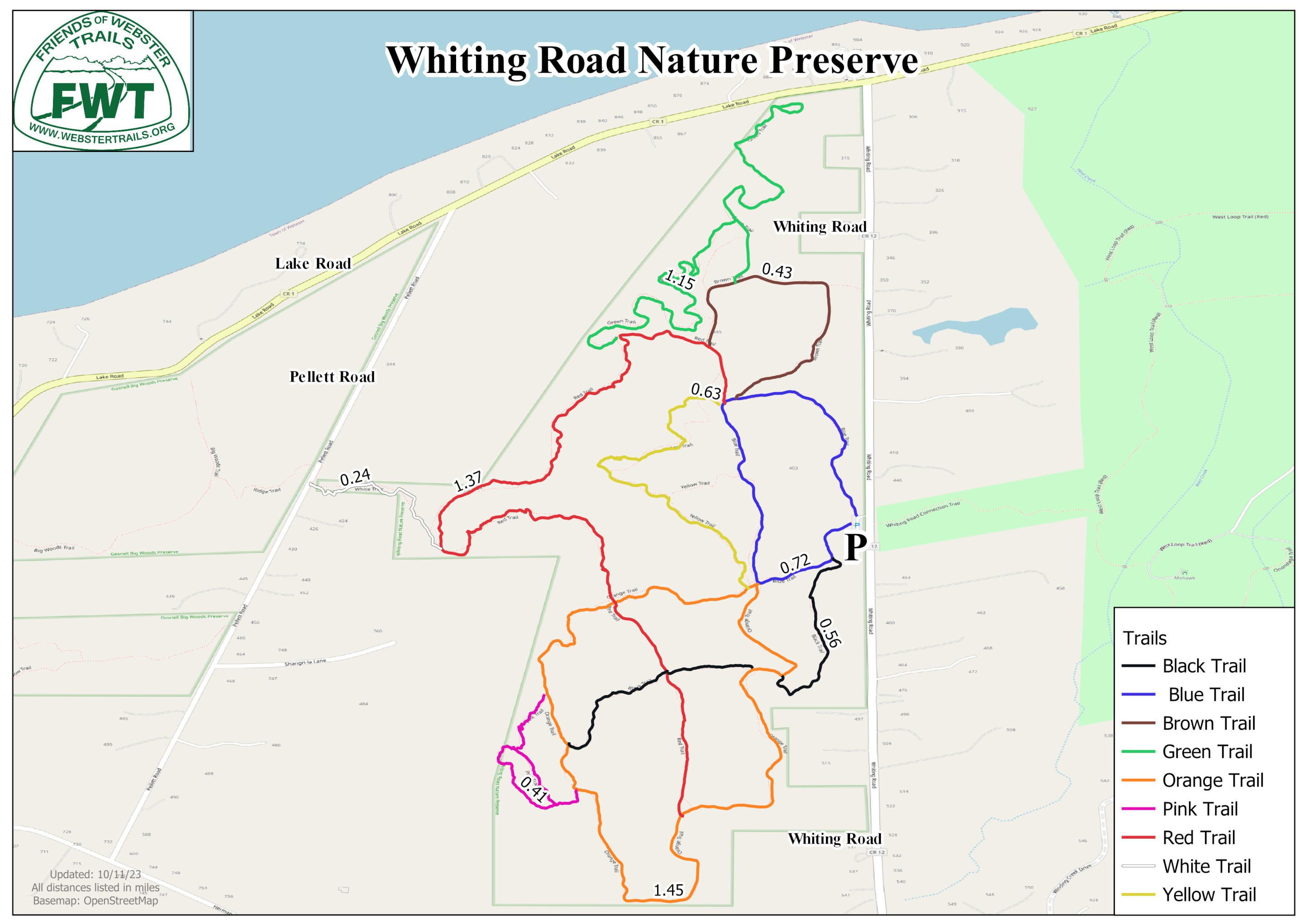
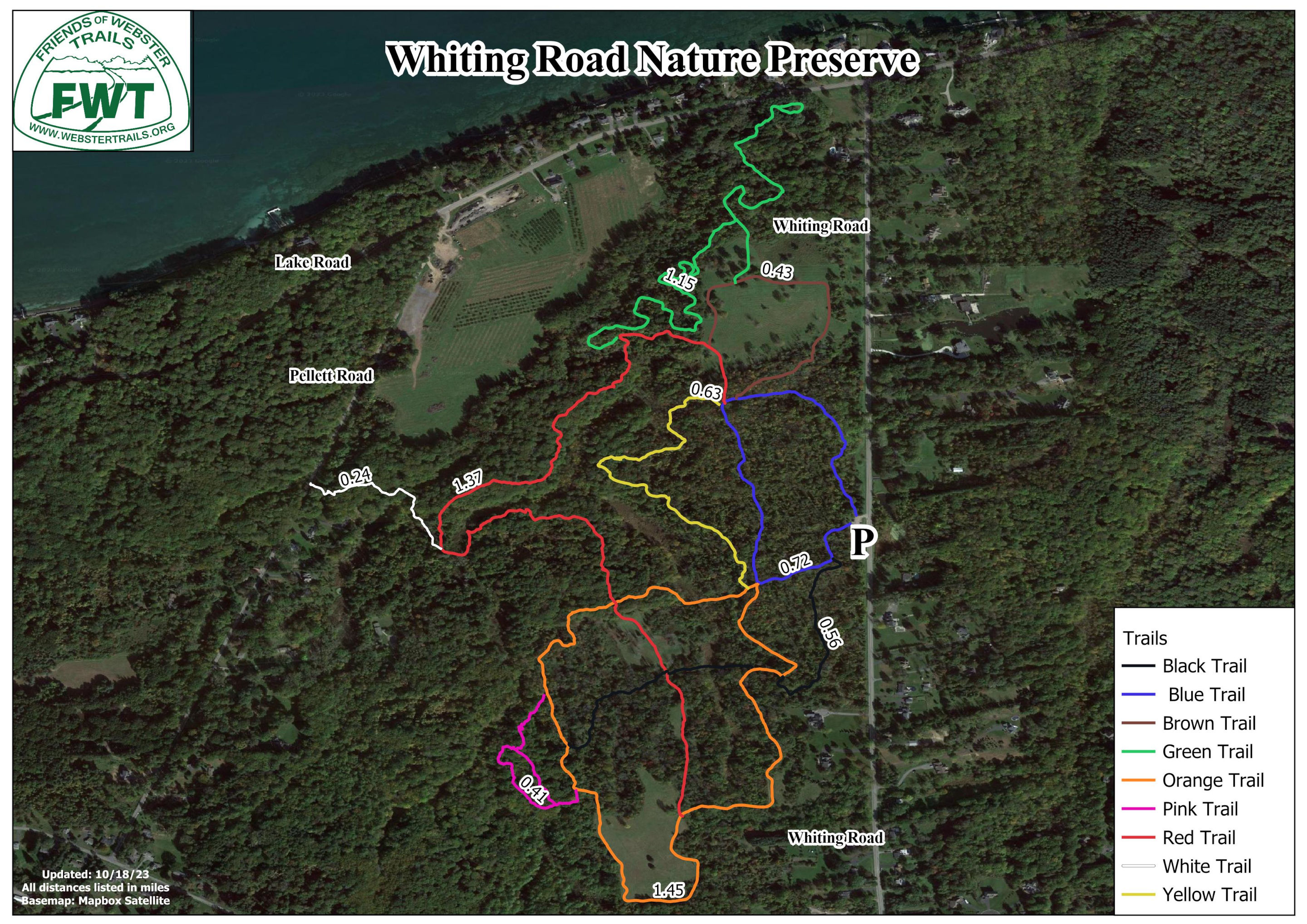
Trails by Difficulty
- Blue: Mostly easy, level trail, with some roots requiring careful footing, through shrub-seedling and sapling pole forest.
- Brown: Easy, mostly level trail through a grassy field.
- Green: Moderate trail with some short steep sections through succession forest.
- Orange: Easy to moderate with some steeper slopes through grass and shrub-seedling areas plus some more mature woods.
- Black: Mostly easy trail with a few slopes and some roots requiring careful footing.
- Red: Moderate trail with long slopes through climax forest.
- Yellow: Moderate rolling trail with a few short, steep slopes.
- Pink: Moderate trail with short, steep slopes.
- White: Moderate trail that connects to Gosnell Big Woods.
Archery hunting is permitted seasonally for those enrolled in the town program. The season starts October 1 and ends in December, with hunting permitted from 30 minutes before sunrise until 10am, and from 3pm until 30 minutes after sunset. Other park users should wear blaze orange when using the preserve during those times.
Resources
History of Whiting Road Nature Preserve.
Norma Platt did a study to document the plants, birds and butterflies occurring in a 3,600 square foot area in the south field.
Whiting Road Nature Preserve is an important bird habitat along Lake Ontario. eBird observations of bird species in Whiting Road Nature Preserve.